
The El Niño Briefing #9: +3.1 °C — the weekly record falls, two months early
Updated: October 2, 2026 · 2 min read · Live dashboard
Numbers of the week
As sent on Oct 2, 2026 — not updated since.
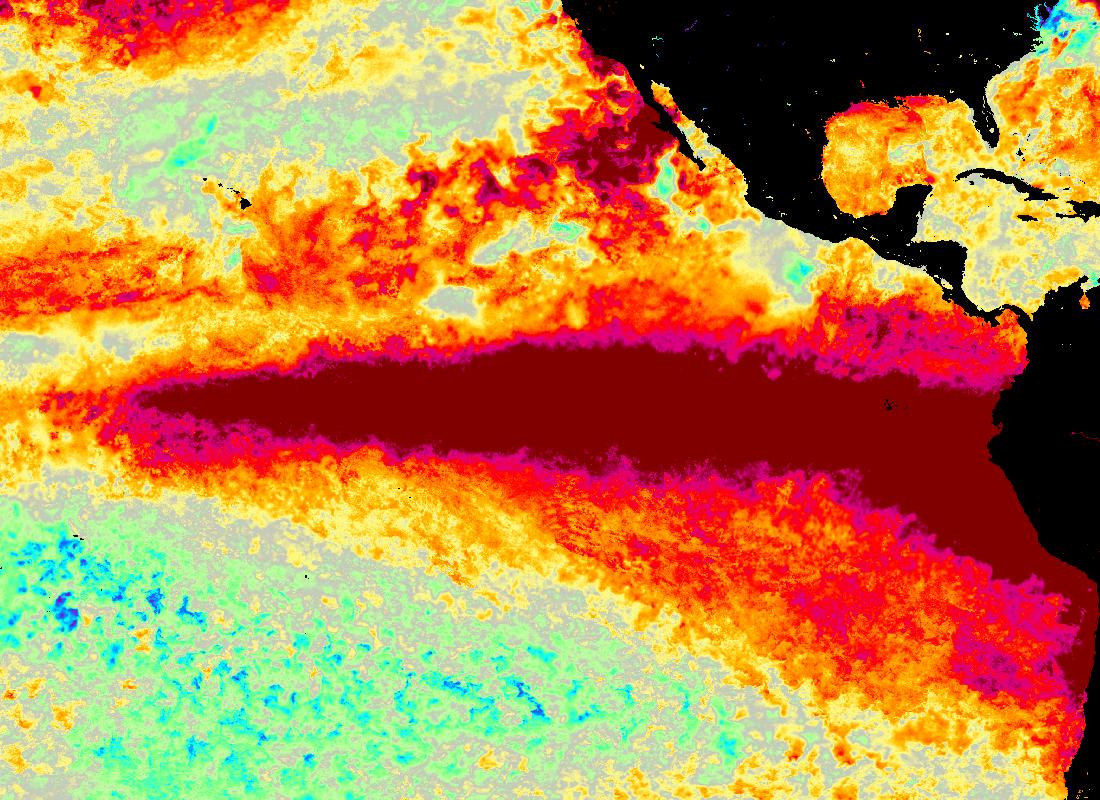
Tuesday's short note carried the number: NOAA's weekly Niño 3.4 at +3.1 °C for the week centred 23 September, the warmest week in a series that starts in September 1981 — above the +3.0 °C of 18 November 2015 and of 16 September, and two months earlier in the year than the 2015 week. NOAA publishes the next weekly value on Monday, so this issue looks at what else the same file shows.
Three regions, three records. The same file has records further east as well. Niño 3 reads +3.9 °C; its highest week before this season was +3.3 °C in November 1997, and 2026 has been above that every week since 2 September. Niño 1+2, off Peru and Ecuador, reads +4.7 °C, above the +4.5 °C of late June 1983 — the highest week outside this year. Only the western box, Niño 4, is short of its record: +1.1 °C, against +1.7 °C in November 2015 and November 2023.
Against 1997 and 2015 at the same point. In the matching week of 1997 (centred 24 September) Niño 3.4 read +1.8 °C; in 2015 (23 September) it read +2.0 °C. Those two events went on to weekly peaks of +2.3 °C (17 December 1997) and +3.0 °C (18 November 2015). The 2026 reading is above both peaks before October has started.
The relative index moved with it. Australia's Bureau of Meteorology relative Niño 3.4 — which, like NOAA's RONI, removes the warming of the whole tropical ocean — reads +2.72 °C for the week ending 27 September, up from +2.53 °C, against its El Niño threshold of +0.8 °C. So the rise is not just the tropics as a whole getting warmer. NOAA's seasonal RONI still stands at +1.36 for June–August; the July–September value has not been published yet.
What a weekly record is, and isn't. It is one week of one index. Official strength is judged on three-month averages, and CPC frames its odds on the three-month RONI. Those odds are still the ones from 10 September: 75% that October–December 2026 is stronger than any El Niño since 1950 (+2.5 °C or more).
Next. NOAA's weekly file updates on Monday 5 October with the week centred 30 September. The next CPC monthly discussion is due on 8 October.
— The El Niño Briefing
Keep reading
The El Niño Briefing
The weekly plain-language digest of the 2026–27 El Niño.
El Niño 2026: Tracking a Potential Super El Niño in Real Time
Declared in June, already strong by July, and forecast to peak in winter — the definitive guide to the 2026–27 event and its super-El-Niño odds.
El Niño 2026 vs. 1997-98: How the Two Events Compare, Month by Month
Same calendar stage, warmer readings: how 2026–27's Niño 3.4 numbers stack up against the benchmark 1997-98 super El Niño, month by month.